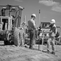
Construction Surveys
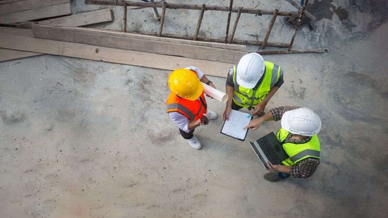
Without exception, successful building projects begin with accurate measurements and careful planning. All Calgary construction businesses that we have worked with over the years rely on precise surveying to ensure compliance with municipal regulations, avoid errors, and keep projects on schedule.
If you are developing a residential property, commercial structure, or a large-scale multi-million dollar infrastructure in Calgary, professional construction surveying is a prerequisite in laying the groundwork for the success of your project.
Axiom Geomatics provides industry-leading construction surveying services designed for architects, engineers, developers, and contractors. Our wide range of services will aid with local zoning laws, property boundary regulations, and structural safety standards.
Why Construction Surveys Matter
Surveying is the jumping-off point for a project that is executed correctly from start to finish. Without proper construction surveying, structures may not meet their approved plans, commonly leading to dramatic setbacks and complicated, headache-inducing legal issues—not to mention an increase to your budget.
Surveys also help in the following areas:
- Verify property lines and setbacks
- Prevent construction delays due to measurement discrepancies
- Ensure proper elevation levels for drainage and stability
- Identify existing infrastructure, such as utilities and roadways
- Support compliance with Calgary’s building codes
Axiom Geomatics for Calgary Construction Surveying
From development permit surveys to lot grading certificates, our highly skilled, expert team of surveyors delivers the precision and reliability you need for smooth project execution. With years of experience in construction services in Calgary, we provide accurate data to keep projects moving forward efficiently.
Explore our range of professional construction surveying services below and learn how we can support your next project:
Development Permit Surveys
When building a new house, the initial step for many property owners, developers, designers, and architects is requesting a survey of the property and surrounding area. This survey will determine the nature and location of the structures that can be built on the property. It also verifies compliance with zoning laws and setbacks, so your project meets all Calgary construction requirements before even breaking ground.

Streetscapes
A Streetscape is the horizontal view of a Development Permit survey and is usually a required component in an application to the municipality for most property development work. This survey helps city planners and architects design streets that blend with the existing surroundings, maintaining local aesthetics and safety regulations.
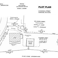
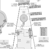
Plot Plans
The Plot Plan displays the intended shape and dimensions of the new building in relation to the property boundaries. It forms the basis of all construction work. The plot plan must be approved by the municipal authority before construction commences. Accurate plot plans are needed to prevent boundary disputes and aid with construction surveying accuracy.
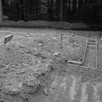
House Stakeouts
A House Stakeout (or Excavation Survey or Basement Stakeout) is a service that marks the ground with construction stakes to identify the location of building construction and the depth of excavation for the basement. It ensures that you dig in the right place. This survey helps prevent expensive errors and helps with site plan alignment.
Main Floor & Footing Elevation Surveys
A Main Floor Elevation Survey or Footing Elevation Survey ensures that the structure being built is of the correct height relative to municipal requirements. Depending upon municipal requirements, you may need either the Main Floor survey or the Footing Elevation survey. Confirming finished floor elevation at this stage prevents drainage issues and zoning violations.
Lot Grading Surveys & Certificates
A Lot Grading Survey is a type of municipal survey designed to determine which direction water will drain from the property and ensure that landscaping meets the Plot Plan specifications. The municipality may require a lot of grading certificates indicating that water drainage is appropriate. Proper lot grading ensures long-term drainage efficiency and prevents costly water damage.
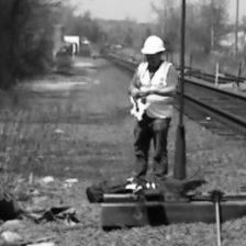
Utility Construction Surveys
A Utility Construction Survey determines where utilities will be located on a property in the future. These utilities include fiber-optic lines, power, natural gas, and water and sewage lines. This survey prevents costly mistakes by ensuring utility placements align with infrastructure plans.
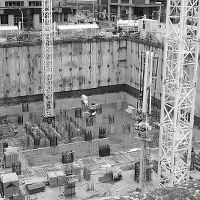
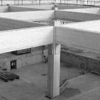
Large Building Construction
Large building construction involves multiple surveys to ensure that the commercial building, high-rise condominium, or parking lot structure projects are built as efficiently as possible. Precision in construction surveying is essential for avoiding compliance issues and ensuring structural stability.
Engineering Surveys
Axiom Geomatics leverages its survey expertise to support other engineering disciplines. This work includes volume calculations, slope stability surveys and more. Engineering surveys help optimize site design, ensuring projects meet Calgary construction standards.