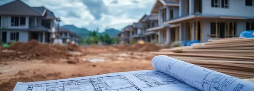
Development Permits
The first step in building a new structure is a Development Permit Survey that shows the existing structures and elevations on the property and is required for the city development permit application. Axiom Geomatics provides the professional surveys and supporting documentation needed to ensure compliance with municipal requirements.
What is a Development Permit?
A Development Permit is official permission from a municipal government (city, town, county, etc.) to undertake a specific development project. Think of it as a "go-ahead" signal that says your proposed project complies with local land use bylaws and regulations. It's not the same as a building permit (though you often need both – more on that later).
A Development Permit document helps developers, architects, and property owners meet municipal regulations and avoid project delays. Often, a Streetscape is also required as part of the municipality's documentation.
When Do You Need a Development Permit Survey?
If you are planning any major changes to a property or building a property from the ground up, a survey is required to support your development permit application in Calgary. Here are some common situations where obtaining a survey is necessary:
- New home construction – From building a single-family home to a multi-unit complex, the City of Calgary requires a permit before work begins.
- Home additions and secondary suites – Projects like extending a house, adding a garage, or converting a basement into a legal rental suite require accurate property boundary verification.
- Commercial property development – Business owners expanding their storefronts, modifying parking areas, or constructing a new building must comply with local zoning regulations.
- Major exterior renovations – Projects affecting lot coverage, structure height, or front setbacks may require a survey for approval.
- Infill developments – Redeveloping an existing lot, such as tearing down an older home and rebuilding, requires precise measurements and planning.
- Land use changes - If a property’s use changes (such as converting a residential space into a commercial one), a survey may be required to determine compliance with zoning regulations.
Skipping the survey step required for obtaining a development permit in Calgary can (and probably will) result in costly revisions, stop-work orders, or municipal fines. Working with a professional property surveyor like Axiom Geomatics ensures everything is in order before submission.

What’s Included in a Calgary Development Permit Survey?
A proper development permit survey includes detailed information that helps the City of Calgary assess whether a project meets zoning requirements.
Here’s what’s usually included in a survey:
- Exact property boundaries
- Lot dimensions and layout
- Easements and right-of-ways
- Adjacent property details
- Required setbacks and building restrictions
- Heights of structures relative to zoning codes
- Utility locations (gas, water, sewage lines)
- Streetscape details, when required
- Existing structures and new proposed changes
- Landscaping and drainage considerations
Note: Having a detailed survey for your development permit provides peace of mind that your project meets Calgary municipal regulations before construction begins.
What's the The Process of Getting a Development Permit Survey in Calgary
Having a Development Permit survey done is not complicated, as you will see below. Here’s how the process usually unfolds:
1. Initial Consultation
Your first step is to contact a certified Calgary land surveyor to discuss the project so that the right type of survey is conducted and all elements are covered in full.
2. On-Site Surveying
A professional survey team will visit your property to take precise measurements, assess existing structures, and identify boundaries. The team will also make a note of all non-compliant features – utility lines or municipal right-of-ways violations are a common example of this.
3. Document Preparation
Once the fieldwork is completed, the surveyor will draft a report outlining the property details. This document will be an official record for permit applications and future reference.
4. Submission to the City
Once completed, the survey is then submitted along with your development permit application. Depending on a range of possible complexities, further documents (or approvals) might be needed.
5. Review and Approval
The City of Calgary will review the development permit submission to ensure compliance with local zoning and building bylaws. If any issues arise, revisions may be needed before final approval is granted.
Starting this process early helps avoid unnecessary delays and usually leads to a smoother, quicker approval timeline.

What is the Cost of a Development Permit?
The creation of a Development Permit Survey document includes a detailed survey of your property (and those adjacent), followed by the drafting of the document. However, as with all survey work, the size of the lot, shape, terrain, and complexity of the property affect the amount of time required to complete the task.
Municipalities may also require additional documentation and fees as part of the application process. For your convenience, we have included links to the various municipalities' websites for information specific to your location.
Get Professional Assistance with Your Development Permit Survey
Axiom Geomatics specializes in providing accurate and reliable development permit surveys in Calgary. Our team has in-depth knowledge of the City of Calgary’s requirements, and we have the experience and knowledge to ensure that your survey is completed efficiently the first time.
We are here to help you complete the process without unnecessary stress or frustrating delays.
Axiom Geomatics provides professional development permit surveys in Calgary, ensuring highly accurate and reliable results. With our experience and expertise, the process of obtaining the permit is far more straightforward, meaning your project can move forward without unnecessary and sometimes costly complications.