What Is a Plot Plan

If you have ever been involved in developing, buying or selling a property, you may have come across the term. But for the unfamiliar, just what is a plot plan, and why is it so important for property developments?
In layman's terms, a plot plan is simply a detailed drawing that represents a property’s boundaries, and the design of the structures, and critical features like easements, utility right of ways, and in some jurisdictions includes landscaping. A plot plan might also include elevations. This important document helps ensure that construction, renovations, and various other property management projects are planned and delivered as intended and without errors. What is also important is what a plot plan isn’t. The plot plan does not show the constructed, or “as built” location of anything, only the planned/designed location. If you want a document showing the real, actual, on-the-ground location you will need a Real Property Report (or RPR). The RPR is also the document you use when buying or selling a home.
What Is a Plot Plan Important For?
A plot plan provides information and transparency in many contexts such as building permit applications, designing the house location, landscaping and outdoor lighting and sign locations. In each instance and more, a plot plan essentially provides clarity by providing a platform to communicate to all the interested parties the plan for the area.
Plot plans ensure compliance with strict zoning and by-laws, help avoid costly mistakes, and facilitate communication between property owners, contractors, and governing authorities clearer and transparent.
What Is a Plot Plan Composed Of?
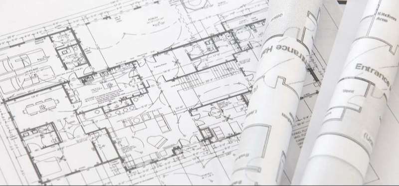
A plot plan is a detailed drawing (or map) that outlines the dimensions and layout of a property, revealing essential features like boundaries, structures, and utilities. You can think of it as a high level view of the intended construction, design, and zoning compliance. If we drill down a little deeper, we can better grasp what a plot plan is through its components, with each one contributing to an accurate representation of the property:
- Property Boundaries
The plot plan clearly defines the exact limits of the property based on legal descriptions. Sometimes these will be derived from the subdivision plan, and sometimes they will be re surveyed at the start of a new big project in anticipation of significant construction efforts. These boundaries help avoid designs that create frustrating disputes over shared or neighbouring land, encroachments into right of ways or violations of bylaws. - Structures
Existing and proposed structures, such as houses, garages, and sheds, are all located definitively on the plan. This offers a visual guide for future construction or modifications. Paved driveways might also be shown. - Easements and right of ways
Easements and right of ways are rights granted to third parties, such as utility companies, to access specific parts of the property. There may also be areas where no development is allowed, or have restrictions on the height of building or type of buildings. These areas are prominently displayed to ensure proper planning. - Utilities and Drainage Systems
Utility structures, drainage paths, and electrical connections are usually included, ensuring compliance with infrastructure and environmental requirements. Gas and water connections as well as power poles are sometimes included. - Landscaping Details
Features like trees, gardens, and driveways are noted, providing a comprehensive overview of the property’s layout.
Quick Reference Table: Plot Plan Components
| Component | Description |
|---|---|
| Property Boundaries | Defines legal limits of the property |
| Structures | Marks existing and planned buildings |
| Easements & right of ways | Identifies rights attributed to third parties |
| Utilities and Drainage | Maps utility right of ways and water drainage systems |
| Landscaping Details | Highlights gardens, trees, and outdoor features |
Purpose and Applications of Plot Plans
Again, a plot plan is an important piece of documentation in various property-related scenarios. It affords precise, clearly defined information that ensures projects are planned and executed effectively.
By clearly illustrating property boundaries, existing structures, and proposed developments, plot plans are a key aspect of maintaining clarity and compliance with legal and zoning regulations.
Applications in Construction and Renovations
Plot plans become part of the process when entering into a new construction or renovation project, helping contractors and architects understand and plan the property layout and ensuring that new structures fit within the allowable boundaries and adhere to local building codes. You might be positioning a new garage, for example, or expanding an existing home - either way, a well-prepared plot plan eliminates guesswork and hopefully prevents costly errors.
Permit Applications
Obtaining permits for construction or land modifications often requires a detailed plot plan. Municipal authorities rely on this document to verify that the proposed work aligns with zoning laws and does not encroach on restricted areas, such as utility easements or setback requirements. A plot plan is, therefore, a prerequisite for smooth and timely permit approvals.
Real Estate Transactions
Plot plans are also indispensable for buyers during property sales, as they can help them comprehend the full scope of the property, including boundaries, easements, and existing structures. Sellers, on the other hand, can use plot plans to resolve potential disputes before they arise, providing greater transparency during the transaction.
Resolving Property Line Disputes
Boundary disputes between neighbours can be contentious, expensive, and deeply frustrating. We do not suggest that plot plans be used to resolve property line disputes - this is better done through a property line stakeout to show the actual property line on the ground marked with nails or stakes.
Compliance with Zoning Laws
Lastly, plot plans are important in ensuring compliance with zoning regulations. Municipalities use them to confirm that developments meet setback requirements, respect easements, and conform to the property's intended use, such as residential or commercial.
Essentially, plot plans simplify planning, reduce risks, and encourage more fact-based decision-making in various contexts. Having a clear and accurate plot plan is almost indispensable regardless of the size of the project—from a small urban home to a large-scale industrial development.
How a Plot Plan Is Created
Creating a plot plan involves integrating data form many sources, legal boundaries of the parcel, righ of ways, field data that shows the location of existing structures and features, as well as the designed location of new items to produce an accurate representation of a property. The process demands attention to detail and adherence to local standards, whether for construction, renovations, or legal purposes.
Let's take a quick look at some of the steps used to create a plot plan:
Step 1: Property Survey
The creation of a plot plan usually begins with a detailed survey of the property. Professional Alberta Land Surveyors visit the site to measure and map the land. Using specialized tools such as total stations, and GNSS (GPS) equipment they collect accurate data about property boundaries, existing structures, and natural features. This step is essential for ensuring the final plan reflects the real-world layout.
Step 2: Data Analysis and Mapping
Once the field data is collected, surveyors transfer the information into a digital product. Computer-aided design (CAD) software is commonly used to generate a detailed plot plan. This software allows for integration and editing of survey data, and design of new structures, clear annotations, and the ability to adjust plans as needed. Incorporating data on easements, right of ways, utilities, and drainage systems ensures the plan is both comprehensive and functional.
Step 3: Collaboration with Experts
Collaboration is key to creating a plot plan that meets legal and practical requirements. Surveyors' work is generally passed over to architects, engineers, and urban planners to finalize the design. These professionals ensure the plan aligns with zoning laws, construction codes, and the project’s objectives.
Step 4: Final Review and Compliance
The plot plan undergoes a thorough review before submission or use. Surveyors and other professionals check for accuracy and confirm compliance with local regulations but the municipality has the final say on the design.
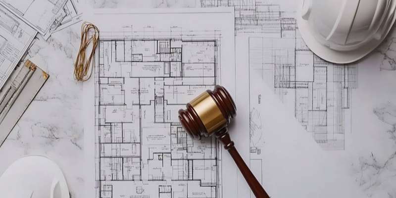
Why Accuracy Is Important
It's easy to think of a plot plan as a technical drawing and nothing more. However, they are of great importance in many ways. The plot plan is the base drawing that supports all the other construction activities on the parcel of land and used for critical decision-making. Ensuring its accuracy protects property owners, contractors, and developers from potential disputes or expensive mistakes.
Hiring licensed legal surveyors for this process is not only recommended but absolutely essential to meeting industry standards and maintaining legal integrity. Within Alberta, an Alberta Land Surveyor is required as soon as any land boundaries are involved.
Bottom Line
Plot plans are essential in property-related projects. They provide a detailed and accurate view of a property, helping homeowners, contractors, and real estate professionals work toward clarity.
When accuracy and compliance are required - as they always are with property sales - consulting full-service legal surveys and geomatics professionals to create a Real property report (RPR) is the direction to go.
If you need a plot plan or require other services, reach out to our trusted local surveyors to ensure your plot plan meets all legal and technical requirements.